Springtime = Earthcache time.
Yep it is that time again. Spring is here, and it is time to get going. I was thinking it was time for me to give advice on getting an Earthcache published. I am surprised as I see there appears to be a number of people that just seem to struggle. Some sail through the process and others get bogged down in minutia They fall in a few categories.
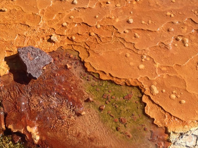
GC5H550 Fin Erosion, Photo by geogriefer from geocaching website
The Historically Interesting
Remember Earthcaching is about the geologic world around you. It is not about the building, dam, fort, city hall, or the history of the ancient people that lived there. We are trying to teach about Geology Yes I know it is a little wider that just the science of geology, I will cover that in a minute. Unless I loose track and start rambling, which happens often.
As much as the building of the dam, the people it displaced, and the history may be interesting it cannot be the primary focus of the cache. If part of your Earthcache is on topic we may ask you to remove it. Some fight tooth and nail to keep it in, but it can't be the primary focus.
I can go here so no permission is needed
Wow this has been a huge fallacy for some time. This is primarily for the US Earthcaches. Differences in laws and land manager policies give other locations different opinions. Recently I asked the other US reviewers. Everyone was pretty much on the same page. You need permission, there can be some leeway for a road pullout, but if you place off road you will be asked for permission.
I have good relations as a reviewer for Earthcaches with many National Park Service, BLM, state parks and other agencies. I regularly get emails from a few of them. I have taken the time when traveling to greet them if they were in their offices. They are good people doing their job. If you want to make them mad, publish and lie about permission. That works for me as well. I have had a few people that apparently lied to me. I have contacted the email given and was told they never asked. On the flip side, a manager from Zion National park contacted me, upset they had not given permission, and was thinking about having a number archived. We pulled records with names and he left happy, after a good discourse. So mistakes do happen.
In another instance a cacher said there was no need for permission and pointed me to the BLM webpage. At the bottom is stated "please contact the BLM office to make sure the location is appropriate. I have had, and seen, a number turned down. For a number of reasons
- Area is closed. Though no signage exists, it is a closed area.
- People were gathering the material to be seen (archaeological, fossils, obsidian, etc) and they did not want to advertise.
- A permit was needed, and contact with the managing agency. They wanted to make sure the site was not advertised.
- Dangerous location.
- Plants/animals were considered endangered.
In the end take the time. They can be a help to you as well.
Take a photo
Yep, not allowed. Since about 2011 a photo requirement is optional. It was not grandfathered. I hear that a lot. I have let a few cache owners know. Log disputes are up to someone else, HQ and the Geological Society, however if the requirements do not meet the guidelines I will go back and address it with the cache owner.
The terrible logging task
I will point to this in the Help Center
An EarthCache teaches an earth science lesson. The cache page must include logging tasks that help teach the same lesson. Remember that the EarthCache is based on the world around us, not on an informational sign at the EarthCache site. Geocachers must complete the tasks before they log the EarthCache as found.
What are good tasks? Tasks that ask people to interpret what they see. How did this form this way? I have one where people try to burn a piece of oil shale, I ask them what they see and learn. Others ask people to describe the formation, and why it formed like that.
What are bad tasks? Eleveation, measure the width of the river, or depth. Find a word on a sign, give me a diameter of the boulder. Remember we are here to teach.
Clastic Pebbele Dikes, photo by oxsling
The wrong earth science
Earth science is pretty broad. For the sake of the Geological Society of America, it means the hard earth, the physical part of our planet. Geology and its related fields.
I know it is sad. I have proposed a few times to people at Groundspeak to create a BioCache or something similar, however until then, we are stuck with using the GSA options.
What is not ok? Biology, ecology, geodesy, archaeology, oceonography, zoology..... I think you get the point.
Wayyyy to many
Once and a while something spreads. Bob places an Earthcache, and everyone copies it. You see a mirror of it all over. So many are limited. We can also see a time when things just are too problematic, they are not bad ideas, but really they are not doable. So what are these?
- Springs,
- Building and decorative stones.
- river confluences
- waterfalls
- artesian wells
- glacial erratics
- river gaging stations
Now an area may be saturated. Yellowstone is buried with caches on geysers. If there is nothing new to be taught, you may not be allowed to list a cache. Every reviewer will have his limits on how close you can have a cache to a similar one.
GC5FM6F, photo by utahsnowflake
What can I do?
Well first, remember it can be a long haul. I have had a few I have worked on for years. I need a bit more info. Many people take a few weeks to a few months to get it listed. I am always impressed with the people that do it on the first try. So do not be discouraged. Don't try and overwhelm the visitor either. This is not a doctorate thesis on geology. Pretend you are teaching a Jr High student.
Remember to take it a step at a time.
- Do I meet the focus of the Earthcache program
- Do I have the science to teach?
- Do I have logging tasks that use what I teach?
- Do I have permission?
Done. See how easy? Ok it is not that easy, but you know what I mean. Take it in steps.


